


In a significant step toward enhancing flight safety and reducing fog-related disruptions across Indian airports, the Indian Institute of Tropical Meteorology (IITM) on Tuesday launched the second phase of the Winter Fog Experiment (WiFEX-II). Building on the success of a decade-long operation at Delhi’s Indira Gandhi International Airport (IGIA), the expanded initiative will now provide runway-specific fog forecasts for several more airports across North and Northeast India.
IITM Launches WiFEX-II to Expand High-Precision Fog Forecasting to Airports
New additions to the WiFEX network will include the upcoming Noida International Airport at Jewar, Hisar Airport in Haryana, and Guwahati’s Lokpriya Gopinath Bordoloi International Airport, among others. The expansion comes as India intensifies efforts to manage severe winter fog conditions that annually disrupt air, rail, and road traffic, particularly across the Indo-Gangetic Plain.
Launched in 2015 by IITM under the Ministry of Earth Sciences (MoES), WiFEX is a pioneering, long-term field experiment focusing exclusively on fog prediction—an often underestimated yet critical challenge for transportation systems.
Speaking at the launch event in Pune, Dr. M Ravichandran, Secretary of MoES, emphasized the growing need for real-time, localized weather forecasts, especially in light of increasing fog-related incidents and expanding airport infrastructure. “WiFEX has not only improved flight safety but also significantly reduced diversions, delays, and associated costs. The expansion under WiFEX-II will bring similar benefits to more regions impacted by dense fog,” he said.

A Decade of Impact: From IGIA to National Deployment
Over the past ten years, WiFEX scientists have used a combination of high-frequency sensors, micrometeorology towers, ceilometers, and other advanced instruments to collect data on temperature gradients, wind speed, humidity, aerosols, soil heat flux, and turbulence. This data has been instrumental in developing a high-resolution (3 km) probabilistic fog forecast model, which boasts over 85% accuracy for very dense fog (visibility under 200 meters).
This forecasting capability has enabled the India Meteorological Department (IMD) and aviation authorities to make more informed decisions regarding flight scheduling, landings, and takeoffs, particularly during the high-fog months between November and January.
“Delhi Airport has served as a live laboratory for the past decade,” said Dr. Sachin Ghude, senior scientist at IITM and project lead for WiFEX. “Now, we are ready to take these insights and technological tools to a larger set of airports that face similar or worsening fog conditions.”
WiFEX-II: What’s New?
The second phase of the program will see installation of dedicated fog monitoring sensors at additional airport sites. These sensors will continuously record hyper-local meteorological data, which will be integrated into WiFEX’s fog prediction models in real time. The resulting forecasts will help airport authorities anticipate fog onset, duration, dissipation, and intensity with remarkable precision—down to the runway level.
In addition to aviation, the data will also support road and rail traffic management, as dense fog has been a recurrent cause of severe traffic accidents and delays, particularly along the heavily trafficked corridors of North India.
Expanding Scientific Understanding of Fog Formation
Beyond operational forecasting, the decade-long WiFEX project has deepened the scientific understanding of fog behavior. The research has revealed how urban heat islands, land-use changes, pollution levels, and airborne particulates influence the formation, density, and persistence of fog.
“These findings are not just helping pilots and airport managers; they’re also informing broader air quality and urban planning policies,” said Dr. Ghude. “We’re now able to make correlations between aerosol concentrations and fog behavior, which will help cities prepare better for both visibility and pollution episodes.”
The insights are already feeding into early warning systems, bolstering India’s ability to deal with multi-hazard weather events.
New Atmospheric Chemistry Laboratory Inaugurated
The launch of WiFEX-II also coincided with the inauguration of a State-of-the-Art Atmospheric Chemistry Laboratory at the IITM campus in Pune. The facility, launched by Dr. Ravichandran, will enhance India’s capacity to monitor and analyze atmospheric pollutants, greenhouse gases, and trace elements that influence weather and climate systems.
“The laboratory will play a vital role in strengthening India’s air quality monitoring and modeling infrastructure,” said Dr. Suryachandra A. Rao, Director of IITM. “It complements our efforts in both fog forecasting and pollution management.”
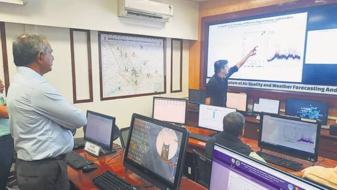
Coming Soon: Air Quality Decision Support Systems for Pune and Mumbai
Alongside fog forecasting, IITM is now preparing to roll out its Decision Support System (DSS) for air quality management in Pune and Mumbai. The DSS is currently operational only in Delhi and is part of the Air Quality Early Warning System (AQEWS) developed by IITM.
This cutting-edge system provides 120-hour forecasts of air quality at a resolution of 10 km, and helps local authorities identify the exact sources of pollution during high-risk episodes. From vehicular emissions to industrial pollutants and crop stubble burning, the DSS maps each contributing factor and recommends targeted control measures.
“We are in the final stages of approval with the Pune Municipal Corporation and expect to roll out the DSS within a year,” said Dr. Ghude. “This tool will be invaluable for municipal authorities, urban planners, and public health officials in their fight against air pollution.”
Looking Ahead
The expansion of WiFEX underlines India’s growing focus on precision weather forecasting, especially in areas with high infrastructural vulnerability and dense populations. As climate change continues to alter weather patterns—leading to increased fog frequency and unpredictability—tools like WiFEX and DSS offer a much-needed technological buffer.
With airports expanding in both volume and geographical reach, and India’s skies growing busier by the year, the role of accurate, real-time environmental forecasting will be central to ensuring safety, efficiency, and sustainability in the country’s transport and urban systems.
“The journey doesn’t end here,” said Dr. Ravichandran. “We are working toward integrating these models with AI-driven platforms, enabling even more accurate and faster decision-making across sectors.”
ALSO READ: Massive Mudslide Hits Kohima–Mao Bypass, Disrupts Traffic and Triggers Road Closures


